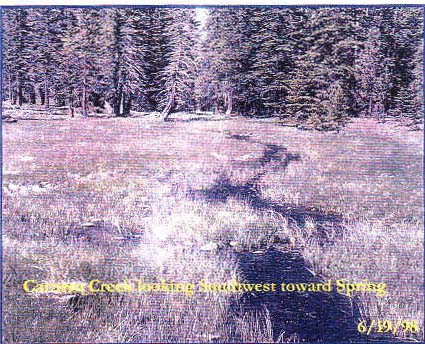
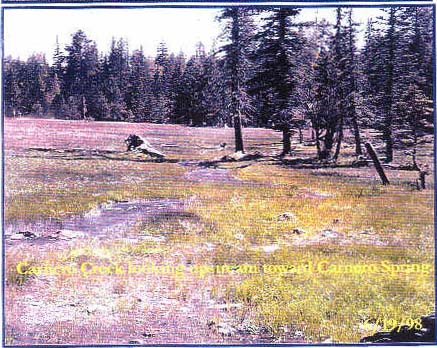
of Carnero Creek - Rainbow Gathering
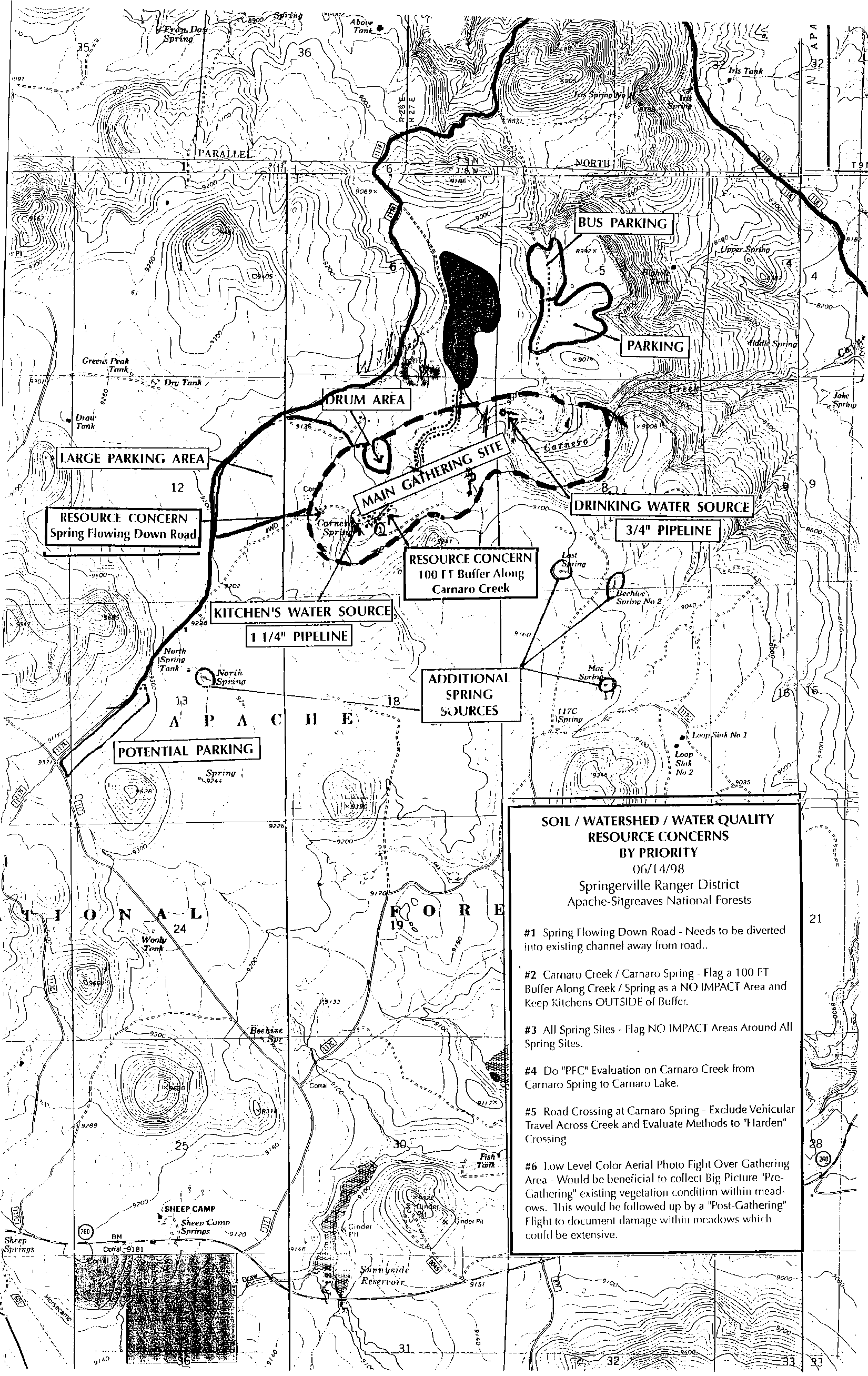
SOIL / WATERSHED / WATER QUALITY
RESOURCE CONCERNS
BY PRIORITY
Author: Brian Davidson
Date: 6/23/98
Addressee: File
Document Description: PFC Assessment of Carnero Creek
Name of Riparian-Wetland Area: Carnero Creek
Date: 6/12/98 Area/SegmentID: 1) Below Miles: 0.75
ID Team Observers: Brian Davidson, Tom Subirge, Karen Stevens
| Yes | No | N/A | HYDROLOGIC |
| X | . | . | 1) Floodplain inundated in "relatively frequent" events ( 1-3 years) |
| . | . | X | 2) Active/stable beaver dams |
| X | . | . | 3) Sinuosity, width/depth ratio, and gradient are in balance with the landscape setting (i.e., landform, geology, and bioclimatic region) |
| X | . | . | 4) Riparian zone is widening or has achieved Potential extent |
| . | X | . | 5) Upland watershed not.conmbuting to riparian degradation |
| Yes | No | N/A | VEGETATIVE |
| . | X | . | 6) Diverse age-ciass distribution (recruitment for maintenance/recovery) |
| . | X | . | 7) Diverse composition of vegetation (for maintenance/recovery) |
| X | . | . | 8) Species present indicate maintenance of riparian soil moisture characteristics |
| X | . | . | 9) Streambank vegetation is comprised of those plants or plant communities that have root masses capable of withstanding high streamflow events |
| . | X | . | 10) Riparian plants exhibit high vigor |
| X | . | . | 11) Adequate vegetative cover present to protect banks and dissipate energy during high flows |
| . | X | . | 12) Plant communities in the riparian area are an adequate source of coarse and/or large woody debris |
| Yes | No | N/A | SOILS - EROSION DEPOSITION |
| X | . | . | 13) Floodplain and channel charactensucs (i.e., rocks. overflow channels, coarse and/or large woody debris) adequate to dissipate energy |
| . | . | X | 14) Point bars are revegetating |
| X | . | . | 15) Lateral stream movement is associated with natural sinuosity |
| X | . | . | 16) System is vertically stable |
| X | . | . | 17) Stream is in balance with the water and sediment being supplied by the watershed (i.e no excessive erosion or deposition) |
Remarks:__________________________________________________
__________________________________________________________
__________________________________________________________
__________________________________________________________
__________________________________________________________
__________________________________________________________
__________________________________________________________
__________________________________________________________
Functional Rating:
Proper Functioning Condition ____
Functional -- At Risk __X__
Nonfunctional ____
Unknown ____
Trend for Functional-At Risk:
Upward ____
Downward ____
Not Apparent __X__
Are factors contributing to unacceptable conditions outside agency's control or management?
Yes __X__
No ____
If yes, what are those factors?
__X__ Flow regulations
_____ Mining activities
__X__ Upstream channel conditions
__X__ Channelization
_____ Road encroachment
_____ Oil Field water discharge
_____ Augmented flows
_____ Other (specify)
SOIL / WATERSHED / WATER QUALITY
RESOURCE CONCERNS
BY PRIORITY
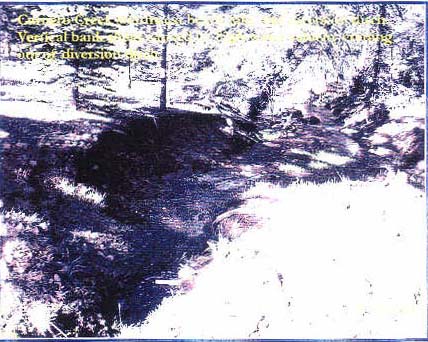
#1 Spring Flowing Down Road - Needs to be diverted into existing channel away from road..
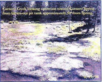
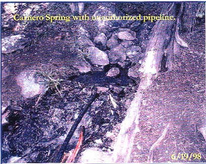
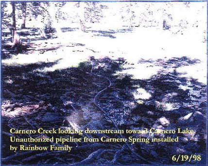
#2 Carnaro Creek / Carnaro Spring - Flag a 100 FT Buffer Along Creek / Spring as a NO IMPACT Area and keep Kitchens OUTSIDE of Buffer.
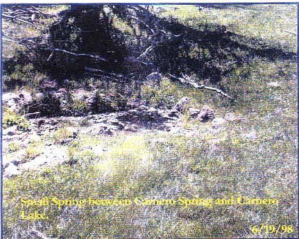
#3 All Snrinn Sites - Flag NO IMPACT Areas Around All Spring Sites.
#4 Do "PFC" Evaluation on Carnaro Creek from Carnaro Spring to Carnaro Lake.
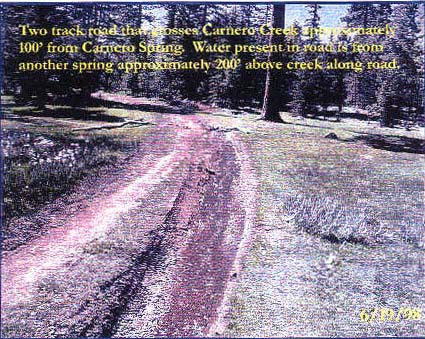
#5 Road Crossing at Carnaro Spring - Exclude Vehicular Travel Across Creek and Evaluate Methods to "Harden" Crossing
#6 Low Level Color Aerial Photo Fight Over Gathering Area - Would he beneficial to collect Big Picture "Pre-Gathering" existing vegetation condition within mead-ows. This would he followed up by a "Post-Gathering" Flight to document damage within meadows whiich could be extensive.
Name of riparian-Wetland Area: Carnero Spring
Date: 6/17/98 Area/Segment ID. 1) Spring to Ditch Miles: 0.5
ID Team Observers: Brian Davidson, Karen Stevens, Tom Sabirge
| Yes | No | N/A | HYDROLOGIC |
| X | . | . | 1) Floodplain inundated in "relatively frequent" events (1-3 years) |
| . | . | X | 2) Active/stable beaver dams |
| X | . | . | 3) Sinuosity, width/depth ratio, and gradient are in balance with the landscape setting (i.e., landform, geology, and bioclimatic region) |
| X | . | . | 4) Riparian zone is widening or has achieved Potential extent |
| X | . | . | 5) Upland watershed not.conmbuting to riparian degradation |
| Yes | No | N/A | VEGETATIVE |
| X | . | . | 6) Diverse age-ciass distribution (recruitment for maintenance/recovery) |
| . | X | . | 7) Diverse composition of vegetation (for maintenance/recovery) |
| X | . | . | 8) Species present indicate maintenance of riparian soil moisture characteristics |
| X | . | . | 9) Streambank vegetation is comprised of those plants or plant communities that have root masses capable of withstanding high streamflow events |
| . | X | . | 10) Riparian plants exhibit high vigor |
| X | . | . | 11) Adequate vegetative cover present to protect banks and dissipate energy during high flows |
| X | . | . | 12) Plant communities in the riparian area are an adequate source of coarse and/or large woody debris |
| Yes | No | N/A | SOILS - EROSION DEPOSITION |
| X | . | . | 13) Floodplain and channel charactensucs (i.e., rocks. overflow channels, coarse and/or large woody debris) adequate to dissipate energy |
| X | . | . | 14) Point bars are revegetating |
| X | . | . | 15) Lateral stream movement is associated with natural sinuosity |
| X | . | . | 16) System is vertically stable |
| X | . | . | 17) Stream is in balance with the water and sediment being supplied by the watershed (i.e no excessive erosion or deposition) |
Remarks: 7 Popr replacing sedges, willows or demise
17 Road crossing needs fixing, stable otherwise
__________________________________________________________
__________________________________________________________
__________________________________________________________
__________________________________________________________
__________________________________________________________
__________________________________________________________
Functional Rating:
Proper Functioning Condition ____
Functional -- At Risk __X__
Nonfunctional ____
Unknown ____
Trend for Functional-At Risk:
Upward ____
Downward __X__
Not Apparent ____
Are factors contributing to unacceptable conditions outside agency's control or management?
Yes ____
No __X__
If yes, what are those factors?
_____ Flow regulations
_____ Mining activities
_____ Upstream channel conditions
_____ Channelization
_____ Road encroachment
_____ Oil Field water discharge
_____ Augmented flows
_____ Other (specify)
Roads waterdiversions livestock, and large "group" events full body contact vehicles toilet stream stocktanks